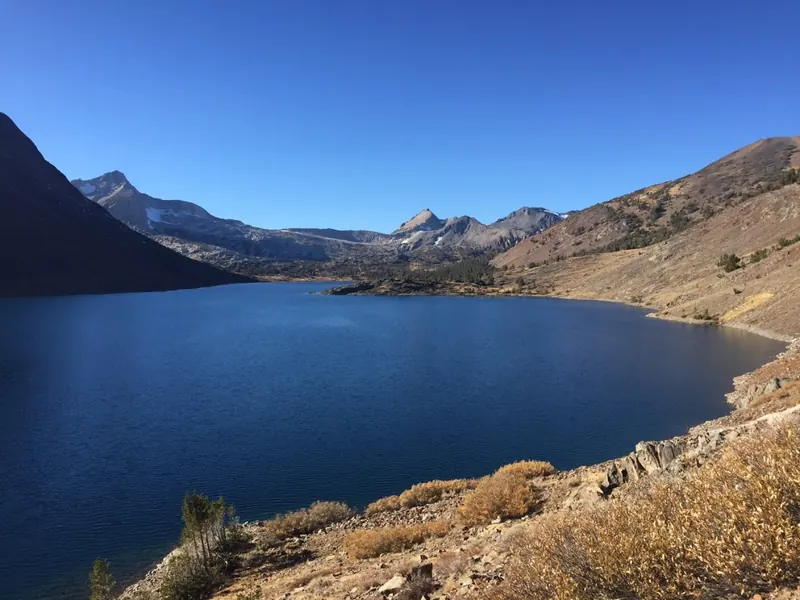
Tioga Pass is the 9,945-foot summit of Highway 120 and the east entrance to Yosemite National Park, the highest highway pass in California. It is open only part of the year, usually from late May or June until the first big storms around November, and it is 27 miles from June Lake.
Where Tioga Pass is
Tioga Pass sits on the crest of the Sierra Nevada between Mount Dana to the east and Gaylor Peak to the west. Highway 120, called Tioga Road inside the park, crosses it on the way from Lee Vining and Highway 395 to Tuolumne Meadows and, eventually, Yosemite Valley. At 9,945 feet it is the highest highway pass in California and in the Sierra Nevada. From the pass the road drops more than 3,000 feet in about a dozen miles to the Mono Basin.
The Tioga Pass entrance station is Yosemite’s eastern gate. It is the only way into the park from the east side, which is why the opening of Tioga Road each spring matters so much to everyone on this side of the mountains.
How the opening works
Tioga Road is not maintained in winter. The National Park Service starts plowing on or about April 15 each year, and clearing usually takes between one and two months. How fast it goes depends on the size of the snowpack and on the April and May weather. The park is clear that the date cannot be predicted, even late in the spring.
In practice the road most often opens in late May or June. A few recent reference points:
| Year | Tioga Road opened | What happened |
|---|---|---|
| 2014 | May 2 | Light snow year; the earliest opening since 1988 |
| 2023 | July 22 | Record snowpack, 244% of average, and storm damage |
| 2026 | May 15 | An early opening |
For every year since 1980 charted against the snowpack, and an estimator for this spring, see our analysis, when does Tioga Pass open. The National Park Service publishes the full year-by-year record of opening and closing dates, with the April 1 snowpack for each year, on its historical dates page. Check it, and the current conditions page, before you plan around the pass.
When it closes
The road closes for the season when real snow arrives, usually in November and occasionally in late October. Early storms can also shut it for a few days and then let it reopen. Once it closes for the winter, there is no way to drive into Yosemite from the east side. Read our guide to Yosemite’s east side in winter for what that means.
Driving to Tioga Pass from June Lake
From the Yosemite Gateway Chalet, follow Highway 158 out of the June Lake Loop to Highway 395, drive north to Lee Vining, and turn west on Highway 120 at the Whoa Nellie Deli. The climb up Lee Vining Canyon is about 12 miles of steep, beautiful road past Ellery and Tioga Lakes to the entrance station. Allow about 40 minutes, and fill the tank in Lee Vining, since there is no fuel inside the park on this side.
Hikes at the pass
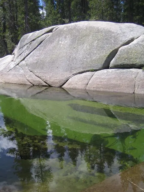
Gaylor Lakes
The classic short hike, starting right at the entrance station. It runs 2.6 miles round trip, with about 500 feet of steep climbing at the start, to a basin of high lakes with views across to the Cathedral Range. Allow two to three hours. Above the upper lake you will find the ruins of the Great Sierra Mine.
Mono Pass
From the Dana Meadows trailhead a few miles inside the park, an 8-mile round trip with about 1,000 feet of gain leads to Mono Pass and the old cabins beyond it. Allow five to seven hours. Strong hikers can continue down Bloody Canyon toward Walker Lake and the June Lake side, the old route between Yosemite and the Mono Basin.
Mount Dana
At 13,061 feet, Mount Dana is the second-highest peak in Yosemite and one of the most accessible big summits in the Sierra. The route climbs steeply from near the entrance station on a use trail. It is a serious day at high altitude: start early, carry plenty of water, and turn around if afternoon thunderstorms build.
Tioga Peak and Gardisky Lake
Just outside the park, a short drive up Saddlebag Lake Road, a steep trail climbs about 0.7 miles to Gardisky Lake. From there, an easy scramble up the northwest slope reaches the rounded summit of Tioga Peak, which has arguably the best view of the whole Tioga Pass region.
Spring skiing at Tioga Pass
For a few weeks after the road opens, Tioga Pass is one of the best spring skiing destinations in North America. Snow lingers on the north faces of Gaylor Peak, Mount Dana and the peaks around Ellery Lake, and skiers come from across the country for corn snow under clear skies. This is avalanche terrain. Go with a guide, or with full avalanche training and equipment.
A little history
The road began as the Great Sierra Wagon Road, built in 1883 to serve the Great Sierra Mine near the pass. The silver never paid, and in 1915 Stephen Mather, soon to be the first director of the National Park Service, helped buy the road and give it to the government. The pass takes its name from the Tioga Mine.
Before you go
- Fees: an entrance fee applies, and nonresident visitors pay more. Check the National Park Service fees page.
- Reservations: the park has used entry reservations in some recent years and not others. Check the National Park Service before you go.
- Altitude: the pass is almost 10,000 feet. Drink water, go slowly, and expect cold mornings even in August.
- Weather: summer afternoons often bring thunderstorms. Be off summits by early afternoon.
- Road status: the National Park Service conditions page and Caltrans QuickMap have the latest.
Where to stay near Tioga Pass
The closest beds are in Lee Vining, about 12 miles from the entrance. June Lake, 27 miles away, puts you among four lakes, a ski mountain and trails from the door. Mammoth Lakes, a little farther, has the most choice. Read our full guide to lodging near Yosemite’s east entrance.
Common questions
When does Tioga Pass open?
There is no fixed date. The National Park Service begins plowing Tioga Road around April 15, and clearing usually takes one to two months, so the road most often opens in late May or June. It has opened as early as April 29 and as late as July 22, in the record snow year of 2023. Our analysis, when does Tioga Pass open, charts every opening since 1980 against the snowpack, with an estimator for this spring.
When does Tioga Pass close for the winter?
Tioga Road closes for the season when significant snow arrives, usually sometime in November, and sometimes as early as late October. It can also close for a few days at a time after an early storm.
Do I need a reservation to enter Yosemite through Tioga Pass?
Sometimes. Yosemite has run day-use or peak-hours reservations in some years and not in others, and the entrance fee always applies. Rules change year to year, so check the National Park Service’s permits and reservations page for your dates.
How far is Tioga Pass from June Lake?
About 27 miles and 40 minutes from the Yosemite Gateway Chalet in June Lake, by way of Highway 395 north to Lee Vining and Highway 120 west.
What is the best short hike at Tioga Pass?
Gaylor Lakes. The trail starts at the Tioga Pass entrance station and runs 2.6 miles round trip with about 500 feet of steep climbing to a set of high lakes with views across the Cathedral Range.