June Lake Trail Map · Hikes
Crater Mountain
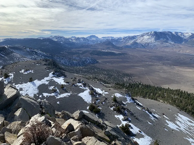
The top of the Mono Craters, the youngest mountain range in North America.

Map by Bill Tipton, made for the Yosemite Gateway Chalet. For planning: carry a real map and check conditions before you go.
The Mono Craters rose out of the desert between June Lake and Mono Lake in the last forty thousand years, the newest only about six hundred years ago. Crater Mountain is the tallest of them. Drive the sandy fire roads off Highway 120 toward the saddle, park at the old barrier, and walk up through Jeffrey pine and pumice. Up top, a brass survey marker, Mono Lake on one side and the Sierra crest on the other.
- Summit
- 9,172 ft
- Round trip
- About 4 miles, 1,400 ft
- Footing
- Sand, pumice, a short Class 2 scramble
- Access
- Dirt fire roads; high clearance helps
Nearby on the map
- Bachar BouldersJune Lake's classic bouldering, in the pines a mile past June Lake Junction.
- Aeolian ButtesPublished bouldering on volcanic rock east of 395, north of the Loop.
- Rush Creek below Grant DamA wild trout stream down to Mono Lake. Open all year, catch and release.
- June LakeThe lake that names the town. A sandy beach, a marina and float-tube water.